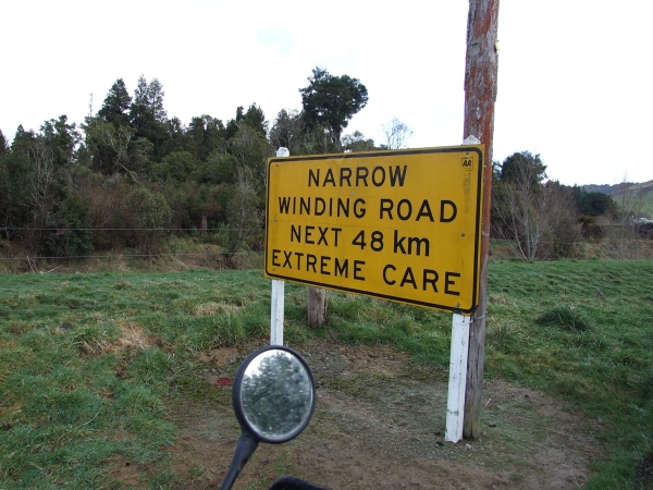
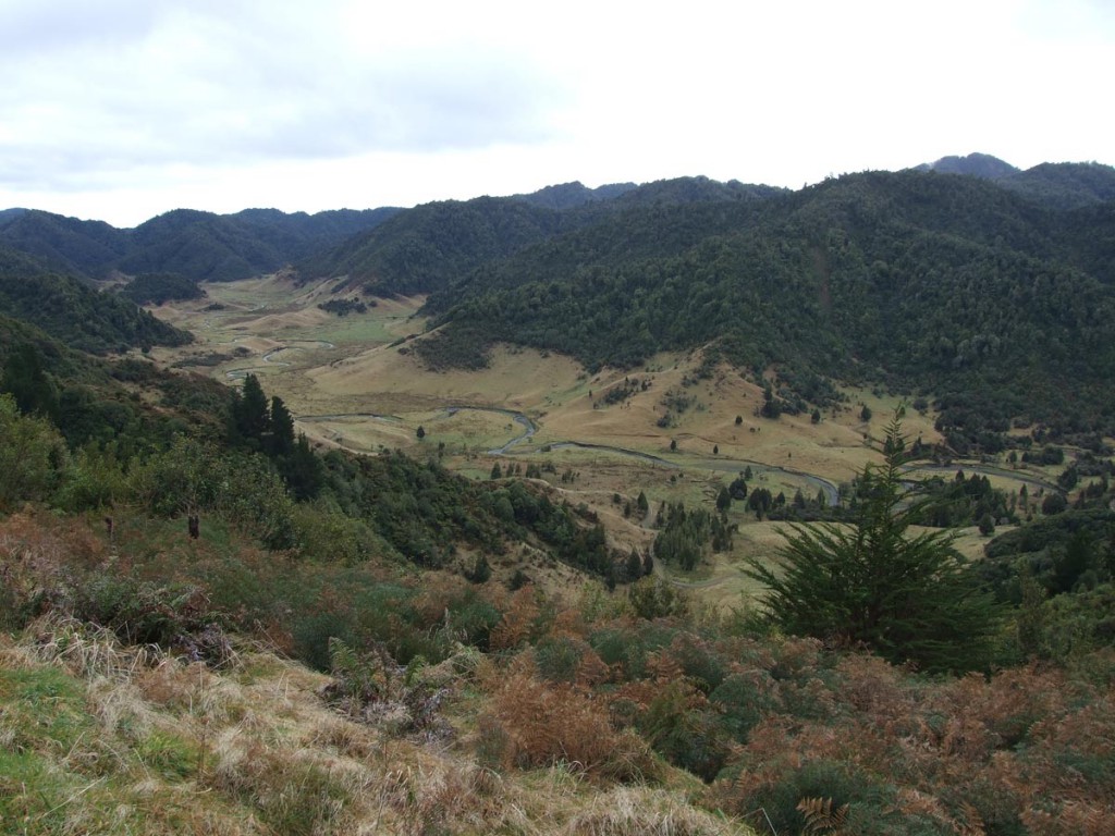
Motu is a tiny settlement approximately 9km east of Matawai which is on SH2 about 10km South of the Gisbourne/Bay Of Plenty boundary and the Motu Road runs from Motu up to SH35 about 8km’s east of Opotiki. Historically the Motu Road was originally a coach trail and later was the longest stage of the Rally of New Zealand but now it’s 48km of windy riding over a range of hills through farmland and native bush. In summer the road is dry and firm however in winter the road can be moist and slippery due to damp leaves and many patches of road that do not get sunlight in winter.
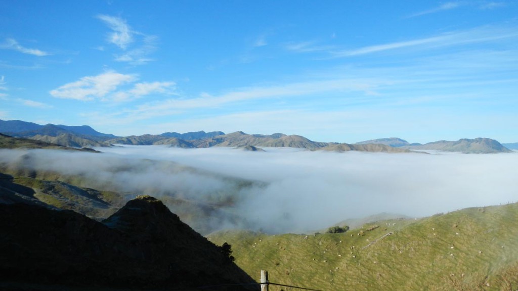
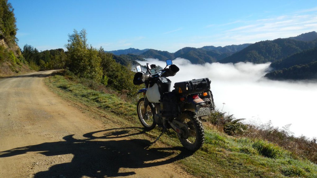
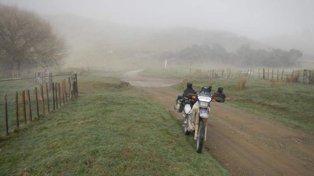
Depending on recent rainfall there could be 3 stream/river crossings, though in recent years even in mid winter the northern most and largest crossing has been dry. Also, in mid winter there can be a very thick, cold fog on the road from Matawai to Motu in the morning, though within 5 minutes of riding up the Motu Road you rise out of the fog for some stunning views of hills poking through the clouds.
The Motu Road is popular with cyclists so it is common to see them on the road also.
Contributed by: @eddieb
Track type: Gravel Road
Track composition: Bumpy, Muddy, Undulating
Slippery when wet? Yes
Suitable for bikes <650cc? Intermediate
Suitable for bikes >650cc? Intermediate
River crossings? Yes
From 4’45” in the video below is the Motu Road.
Had a pretty good ride down the Motu Road yesterday. I was staying in Opotiki and @Jake Maryniak was riding from Hamilton to Gisbourne so we connected up and did a bit of gravel.
Watch out for stupid mountain bikers on the North end of The Motu, I had one hit me as I was heading uphill around a blind left hander and he was coming downhill on the wrong side of the road, he locked up his brakes and side swiped my leg. His mate about 20 meters behind put himself into the ditch to avoid me.
At the ‘river crossing’ which was dry again we met Folker Liebenow on his classic BMW, his son had gone past 30 seconds on his similiarly aged italian scooter.
At the South end of The Motu we had a look at Motu Falls.
MaruMoko Road just off the South end of The Motu could be worth a look. I’ve just checked it out on Google maps and it could be interesting.
The Motu stream was flowing pretty well last weekend
https://www.facebook.com/motucycletrails/videos/1151810631591843/
Oh crap! I’ll be sure not to do any river crossings when the stream is in spate.
The Motu Road is currently listed as closed on the Gisborne District council website due to “the ford crossing on the Opotiki side is damaged and not passable”, presumably due to the water flow shown in the video above.
SH2 through the Waioweka Gorge is also closed due to a big slip.
Local road closures in the area including the latest Motu Road updates can be found on the Gisborne District council website at: http://www.gdc.govt.nz/road-information/.
Hi all. I came through the Motu last Thursday. Although there is a sign on the Gisborne side that the road is closed there is nothing on the Opotiki side. Strem crossing is straight forward and I realy did wonder what the fuss was all about. Definitely saved me a trip over the East Cape as SH2 was closed. As always check out the weather as we have had a bit of rain lately.
The Motu bridge is about to be replaced which may make access across it patchy until such work is complete.
https://www.facebook.com/Kiwipiloting/posts/960484054089738
Pics of the 2 water crossings I came across (not sure where the 3rd one was) 1st was more of a puddle, 2nd was actually deeper than it looks but no worry.


Wednesday 2 January.
‘@Alvin Olson Rode the Motu a week or so ago.
https://www.youtube.com/watch?v=a9C7lp-S5ys
The Motu Road 29/09/2023
A little rain damage. Just got to first ford and u turned from Opotiki End. Road wash out in Takaputahi Road.
We went though the Motu road yesterday (Matawai to Opotiki direction). At the moment it is a smooth cleanly groomed trail of fine compacted gravel. Both fords were little more than puddle splashes. There were warnings about logging trucks working at the Opotiki end of the road, and this section is typical gravel road. While we were in Opotiki we saw advertising for a service ferrying mountain bikers to the top of the road. If you have a choice, I would recommend starting at the Matawai end to lower the risk of meeting thrill seeking cyclists head on as they come down the road.