


Thanks to @jonibarteam for kicking off this project and @ray_taylor, @frotz, @simon_Kerr, @Isaac_Bain and @eric_yu for jumping in and adding their expertise.
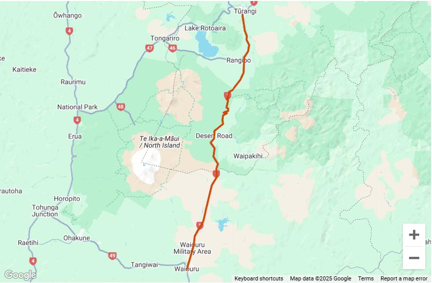
The map below shows all unsealed/gravel roads in NZ over 5km long.
This map is based off data provided by Land Information New Zealand (LINZ), changes to a roads status since the LINZ data was last updated e.g roads being sealed or temporarily or permanently closed will not be reflected in the map below.
Click on the little menu toggle button ![]() on each map below to open the area selection menu to choose which tracks to display. While you can have all tracks in both islands open at once, the more areas you have displayed the slower moving the maps around will be.
on each map below to open the area selection menu to choose which tracks to display. While you can have all tracks in both islands open at once, the more areas you have displayed the slower moving the maps around will be.


Thanks for your efforts @Eddieb.
If @eric_yu made the data file available could we get our own QGIS accounts to import it into? Is it that simple? Shouldn’t trip the commercial use issue that way.
I tried dividing the file into North and South Island to make the files smaller but they still won’t show up.
Aside from the size I’m not sure why as I’m using the same code that displays the North and South island rides maps and the file loads into Google earth fine.
‘@Scott Palmer @eric_yu
So the issue will displaying the All Unsealed Roads maps is that the file size is too large. The free Google Maps Javascript API which I use for the other maps has a limit of 3mb for KML files, even after splitting the data into North and South Islands the smallest file was still 4mb.
So far I think I’ve found 3 possible options
Thanks for the update @Eddieb, fingers crossed!
Sorry guys, I was busy moving to south island. But now I am back with a solution, you see google maps won’t let you upload KML larger than 5MB or 1000 features per layer, so inspired by @Eddieb I chop it up by regions, simplified the lines a bit to further reduce size, split them by islands because there is another limitation of 10 layers per map(argh!), and finally here you go guys:
I have removed roads shorter than 1KM but as pointed out previously by another member some roads are recorded in multiple shorter lines by LINZ, so this time I have merged them by their names first hopefully we won’t accidentally removed them, with a side effect that all roads with no name in the same region got merged together(not a big issue I think, I’ll fix it next time). And due to how KML works it will load the whole datasets when you enable the layer, beware if you enable too many layers it may becomes very slow.
Hope this is gonna last, whew
OMG @eric_yu that is epic! Thank you so much!
I have added the maps to the body of the page. If it is too unweildy having both on the same page maybe I could split them out to separate pages, we’ll see what people think.
Legends, thanks @eric_yu and @Eddieb
I can only see the roads on the South Island map, North Island is the standard Google map only….
@PeteC Did you click on the little besides where it says ‘NZ North Metal Roads’ at the top of the North Island map window??
Its working for me.