


Thanks to @jonibarteam for kicking off this project and @ray_taylor, @frotz, @simon_Kerr, @Isaac_Bain and @eric_yu for jumping in and adding their expertise.
The map below shows all unsealed/gravel roads in NZ over 5km long.
This map is based off data provided by Land Information New Zealand (LINZ), changes to a roads status since the LINZ data was last updated e.g roads being sealed or temporarily or permanently closed will not be reflected in the map below.
Click on the little menu toggle button ![]() on each map below to open the area selection menu to choose which tracks to display. While you can have all tracks in both islands open at once, the more areas you have displayed the slower moving the maps around will be.
on each map below to open the area selection menu to choose which tracks to display. While you can have all tracks in both islands open at once, the more areas you have displayed the slower moving the maps around will be.


Maps aren’t showing up of the Islands. It might be my old Mac Laptop doing some security bullshit but thought I would just mention
@KiwipilotR1200gs
Click on the little menu toggle button All Unsealed Roads Map Toggle Button on each map below to open the area selection menu to choose which tracks to display. While you can have all tracks in both islands open at once, the more areas you have displayed the slower moving the maps around will be.
Now that would be very useful … look forward to that, and thanks.
Oh, that sounds good. Very keen for it.
What sort of info is needed? How can we contribute?
WAMPS has public access roads and paper roads mapped out, which I use a bit.
And I have also got a few kml files from LINZ for various purposes – not sure if they have sealed / unsealed status in their records or if that is up to all the local councils to keep track of.
Hi Guys,
Here you have the first piece.
This is a map with all the unsealed roads in the North Island.
This is RAW data from LINZ and does not provide information if the road is public or not… that is the next step.
Blue Roads are unmetalled (Dirt) roads.
Red Roads are metalled (Gravel) roads.
Link for to download North Island Unsealed roads
If you click one road a info box pops up with the surface and name of the road.
Some (most) I would guess are private or only provide farm or property access but they are easy to spot, general they look short in the map.
Ways to contribute:
Anyone that knows how to code in Python.
A list of public roads would be nice so that we could exclude the ones that are private.
Adding some of this info to openstreetmaps would also be very useful as it would provide information to GPS apps.
Next steps:
Add the South Island Map.
Add the Tracks map (the ones vehicles can go on)
Remove Private roads from the map.
Enjoy, are happy riding.
PS: Edward funny enough the “Joni” in Jonibarteam is a guy. 😀
Cheers
Haha, Fixed
Assumptions make an ASS out of U and ME
I was going to set up a page with the file overlaid on a google map, and overlaid on a topo map, but the file is too big to render on the page.
Hi all, nearly back from epic riding overseas. i downloaded the link (from here in Singapore airport), but what file opens it? Thanks to all who are working on this. It will be a massive tool for the riding community 🙂 🙂
KML can be opened by Garmin Mapsource or Basecamp, or GoogleEarth, not Google maps though.
I had a look at some of the Wellington metalled roads. Good luck with getting access to a bunch of them. That said, there are a few there that I’m completely oblivious to, so a good excuse to see if i can ride them…
Hi,
Yes the problem with LINZ data is that is does not have info regarding the access type of the roads (public or private), I had a conversation with them and they said that they don’t have that info…
I was redirected to WAMPS but the info is also not usable, and the site it self is sooooo sloowwww.
So it has to be a team effort… and all are excuses to to go and check 😀
Cheers
Whats the difference between blue and red lines?
All of the blue lines I have looked at in the waikato/Coromandel were private driveways rather than roads.
I couldn’t get it to load in Mapsource but Goolge Earth worked, though it’s slow.
After a bit of messing around I managed to get it on both Google Earth and Basecamp … all good. It certainly makes finding gravel a whole lot easier. Thanks!!
Cool. I’m a Python programmer. What kind of coding did you have in mind? Does WAMPS provide accessibility info? Merging that seems really useful, if possible.
Hi frotz
Yes Wamps does have some information, however I see no API.
A good thing would be to try and link this data with Openstreet maps.
Send me your e-mail via PM, and we can start having some chats about it.
Cheers
The roads that the LINZ data service gives you should be all public roads – some will be paper roads which are still public roads and the public can access them.
Here is an email I got from LINZ a few months ago when I was asking for a map of all the paper roads in the north island. I think this will provide most of the information that is needed – private driveways should not appear on the linz data as they are unrelated to property parcels.
Hi Ray
The data that we make available is on the LINZ Data Service https://data.linz.govt.nz. It is free , although you will need to signup and register to download data.
One of the download formats is KML
I suggest that you visit this page http://www.linz.govt.nz/data/linz-data-service/getting-started ensure that you know how to find data, download etc.
Note that in the “Crop selection” there is the ability to use some predefined boundaries such as Territorial authorities.
There are two datasets that might be of interest to you.
1. Topographic roads from the Topo50maps – NZ Road Centrelines (Topo, 1:50k)
2. Electoral roads from Landonline – NZ Road Centre Line (Electoral)
It is really important that you read the metadata on what these layers contain. Generally the Topo roads are as mapped at at 1:50,000 scale. The Electoral roads are more of a label holder for roadnames, but they have a stronger relationship to the cadastre.
Also note that the Road Parcels layer holds the cadastral parcels that were intended to become road (there would be a very small number that didn’t) these can be used in combination with the various road centrelines to identify “paper roads” (there is no specific identifier in the data that flags paper roads).
Lastly, given that you’ve asked about “paper road” I suggest that you check out the walking Access commission http://www.wams.org.nz/. They have undertaken significant work to identify and maps this type of info
Regards
Andrew
Thanks Ray. It looks like the WAMS data can be downloaded here:
http://wams.org.nz/ArcGIS/rest/services/WEBSERVICE/WEBSERVICE_Public_Access_Areas/MapServer
Also, here is a “data request” from September 2012 that says “if you would like a supply of the Public Access Areas data, please contact GIS@walkingaccess.govt.nz and a timestamped copy can be supplied to you.”
https://data.govt.nz/datasetrequest/show/114
Hi Ray, unfortunately LINZ has no such information as a layer, for example if you look for Deacon RD in Riverhead forest it comes listed, without any info about public right of access…
Cheers
Boy thats a weird one.
So first there is a Deacon Road which appears to be an urban road.
Then there is Deacon Road which runs through what appears to be a forest which is privately owned by Rayonier.
This does not appear on the WAMS.
LINZ call it Long Bush Road
It does appear as Deacon Road on google earth. Perhaps a road name change took place at some point in time when the council sold off the forrest or something like that.
But anyhow, it doesnt appear on the WAMS maps or so its private.
And another key indicator is if you look at the LINZ data type “Primary Road Parcels” it will show all public access.
If you can get data in bulk from WAMS then that will be the most accurate though its based on LINZ data, overlaid on a topographic map.
Hi Ray,
Deacon Rd is just an example as I know it is within Riverhead forest and indeed private, however your tip about the Primary Road Parcels is a very good tip.
@frotz I think we can work with this info.
Cheers
Is it possible to download a subset of the “Primary Road Parcels”? The KML is 84MB, and there’s a download limit of 40MB:
https://data.linz.govt.nz/layer/796-nz-primary-road-parcels/
I’ve made some progress on a Python script that can estimate road length from a LINZ KML file, so we can focus on “interesting” roads.
In the top right of the scrren is a little crop icon next to the download button.
You can crop an area and only download the content within that area.
It might also be wise to look at a way to present this as a “Live” kml or kmz.
Google earth can look at a kml file on your desktop, or it can look at an http address and a file hosted on a server.
The maximum file size that google earth can look at is something like XXmb but the server can host a huge file and google earth only requests the data on screen at the time.
I am not entirely sure how that works through.
You can see how that concept works by looking at the geodetic placemarks.
1) Right click my places in google earth > Add > Network Link
2) Set the link to http://apps.linz.govt.nz/gdb/gdbkml.aspx?
2) Refresh Tab > View Based Refresh > When: On Request
Or you can use this link url to see all the DOC huts in NZ
http://geoportal.doc.govt.nz/arcgis/services/GeoportalServices/DOC_Huts/MapServer/KmlServer?
Interesting… that limit is new.
I have the following files.
NZ Road Centre lines 1:50 – 140MB
NZ Track Centre lines 1:50 -99MB
We will have to download 40MB sections for now, and generate 1 single file, I can do that.
Here is the link for the South Island Metalled and Unmettaled roads NZ South Island Gravel Roads
Ray, agree, once this is finished I think this should be hosted and downloaded by google earth instead of having massive kml files.
We will have to find out how to have it running.
I am happy to help there if I can once we find out what the requirements are.
Cool thanks.
Should not be much.
Thanks Ray, cropping works around the download limit.
However, the “Primary Road Parcels” KML doesn’t seem to have a “surface” data field for each road, so it doesn’t seem easy to filter out paved roads.
The link I previously posted for the WAMS data doesn’t seem to lead to any usable data. This seems to be the official portal:
https://walkingaccess.govt.nz/walkways-and-access/walking-access-mapping/gis-data/
But it doesn’t seem to provide a bulk data download. It says:
“The layer can be used as an ESRI map service:
REST END POINT: http://wams.org.nz/ArcGIS/rest/services/WEBSERVICE”
I think I’ll email them for a data dump. In the meantime it looks like I’ll have to update my ancient Mac to use newer Python libraries. Sigh. (Need lxml? Need MacPorts. Need Xcode. Need a newer OSX. Need to free up some disk space. Sigh.)
Gale force winds in Wellington today, so it’s a good day for coding! I’ve written a Python script that can filter out roads in LINZ KML files (Here, if you’re interested). Currently it drops short roads, but it’s easy to extend it to do other things. Let me know if you have any ideas.
Here are longest 10% of the unsealed roads in JoniBarTeam’s KML files:
Looks like an excellent little bit of information….looks like unsealed roads are fast disappearing
As those ‘Long Roads’ files are relatively smaller than the full extracts I tried embedding them in a Google maps page using the same code as the GPS tracks maps use but for some reason the map just comes up blank, e.g Linky for North Island Longest Roads map
EDIT: Might have found the reason, the character encoding in the Description field at the start of the document is fudged but I can’t quote it here as it renders correctly in a browser.
It would be cool to get that working. I don’t know much about using KML in Google Maps.
Can you try these? They’re even smaller (min road length 5 km) and I’ve manually removed the description, which had some encoded HTML in it (from the original LINZ sources), which might have been rejected by Google Maps for security reasons.
I found a pile more encoded HTML for all the brackets in the in the Balloon styles at the end of the document which I updated using find and replace but still no joy.
I’m using an iFrame which calls an HTML file which sets up various parameters to display the map and calls some Google js.
[iframe src="https://www.adventureridingnz.co.nz/wp-content/uploads/gpx/unsealed_NI.html" width="100%" height="900"]
Frotz, thanks for the files. I’ll have a look at them.
Eddie, can you create one KML file with any road that you can load into your google maps link?
Maybe we can alter the new ones to match the xml and that would fix the issue.
Cheers
Just messaged you, I sent the same message to @frotz earlier.
Hi Frotz,
I was having a look at the kml generated files and I found at lease one “big” road that was removed.
Have a look at TE AKAU SOUTH ROAD, it looks to me that it is longer that 5km.
It is visible on the 10% longest… BTW.
Hi All
What a great site.
I am coming to NZ on my fourth trip on bikes. This time a mate and I are hiring two DR650’s and have four full days. We have R1200GS’s back here, but they won’t hire them for gravel really anywhere in NZ, so we are going to have 4 days.
We would really like some advice on routes we could take. This forum is great as is this thread, but we were hoping maybe to find a largely gravel way of getting to Napier from Auckland starting on a Friday and probably keeping to the north and back to Auckland by Monday afternoon. Napier might be unrealistic, but wines.. you know how it is.
But perhaps there are some thread I can look at ?
Will come back with more time next time.
I would really appreciate any help !
Brad (and Dave)
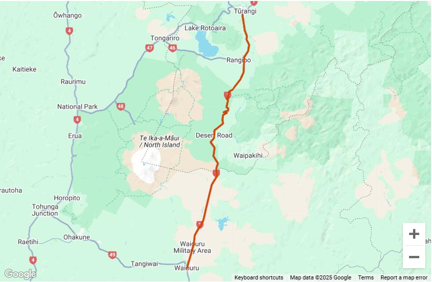
Hi Brad, I haven’t ridden it myself, but SH38 looks like a fun road, so you might be able to incorporate that:
https://www.adventureridingnz.co.nz/gps-tracks-rides/north-island-tracks/sh38-lake-waikaremoana/
I sent an email to WAMS and got a very helpful reply from Steve Lau (Steven.Lau@walkingaccess.govt.nz):
This sounds like exactly what we’re looking for, although we might want to filter out short roads and split it up into manageable chunks (e.g. to embed in Google Maps).
The zip file that Steve has provided appears to be “geodatabase”. I don’t have any experience with this database format, but apparently it’s used by ArcGIS and is widely supported. I suspect it won’t be difficult to generate KML (etc.), and if we have any trouble it sounds like we can ask the folks at WAMS for help.
I haven’t had a chance to dig into the database. I’ll keep you all posted.
Hi Frotz,
Great piece of information mate.
That is exactly what we are looking for… now we just need to build the KML file.
(working on it)
Cheers
Hi Frotz
that’s one we will be doing,
Will update you
Brad
Hi everyone – I was referred here by my bro (@Feral Matt), via FB. Can’t remember my login details for this forum, so I’ve logged in via my FB profile.
Disclaimer: I don’t ride, but have a bit of amateur experience on the mapping side of things.
Recently I’ve been building an online map for hunters, but it could also be useful for other outdoor users such as adventure riders. I got pissed off chopping and changing between various different online resources (Google Maps/Earth, data.linz.govt.nz, wams.org.nz, doc.govt.nz) to get the full picture of were I wanted to explore, so I have taken publicly available bits and pieces from each site and fed them into my map.
It is build on a javascript system called Leaflet, and seems to be reasonably straight-forward to build with. My programming kung-fu is pretty lousy – what I’ve managed to create so far is from plaigarising other people’s examples in Leaflet. Seems to be the thing to do, since it’s open-source and all.
Let me know if there’s anything I can help with.
Take a look at my map (not properly hosted yet – just sitting in my Dropbox).
P.S. Re: https://data.govt.nz/datasetrequest/show/114 mentioned previously in this thread – that was me.
Hi Simon,
I had a look at your map, and it it great stuff indeed, all it needs is a way to “remove” merge and only show ROADS, instead of everything, but a very good one though.
Thanks for sharing.
Cheers
Like so? https://dl.dropboxusercontent.com/u/7075784/Leaflet/Leaflet2_NZADV.html
As a side-bar conversation – I’m going to have a play around with using an android tablet as a nav tool on the bike. I far prefer navigating off a bigger screen, and often I find my Garmin 62s screen is a bit poxy to read ‘on the fly’. With a bit of ruggedisation, and by downloading dataset layers, I think it would be a good contender for a nav device. 3 G enabled then also allows for live tracking etc using Glypse or whatever other app one prefers rather than draining your smart phone. I won’t hijack this thread any further, but my point is that nav data has potential to be integrated into the right hardware platform for a complete Adventure Riding solution. I’ll start a new thread once I’m back in NZ in the coming weeks and report on it there.
Simon, MANN you are fast 🙂
What I meant by only Roads I should have been more precise, “gravel roads” the ones we like to ride in.
The purpose of this thread is to build a map that has all the “Gravel Roads” in NZ that we can Ride a motorbike on because they are public like normal gravel road but also the paper roads, that some times are closed by gates, and unless you know you would not go into it.
Cheers
Feral Matt, I’m also considering doing the same.
Cheers
Is this more like it? https://dl.dropboxusercontent.com/u/7075784/Leaflet/Leaflet2_NZADV.html
A word of warning: I’ve filtered out all the sealed roads, so only metalled and unmetalled roads remain, but have not filtered based on a minimum length, to get rid of all the little scrappy pointless ‘roads’ that are, say, less than 1km long. What this means is that if you engage the metalled/unmetalled layers at larger maps scales, it may choke, and map responsiveness (panning, zooming, etc) will be degraded.
It’s easy enough to strip out the short roads, it’s just that my PC with GIS tools is U/S at the moment.
Hi Simon,
Definitely you re on the right track, yes that is exactly what I had in mind.
And I agree with you, it is important to strip out short roads, for performance, and from what I found most of these small roads are unmetalled “dead ends” in farms and the likes.
Thanks for the good work.
What is it that is needed to host your “Map” ?
Cheers
It can probably just go under the ‘Tracks & GPS’ tab at the top of the page?
I will tidy up the code (remove a bunch of stuff that’s not relevant) before it gets embedded in this forum.