


Thanks to @jonibarteam for kicking off this project and @ray_taylor, @frotz, @simon_Kerr, @Isaac_Bain and @eric_yu for jumping in and adding their expertise.
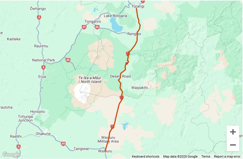
The map below shows all unsealed/gravel roads in NZ over 5km long.
This map is based off data provided by Land Information New Zealand (LINZ), changes to a roads status since the LINZ data was last updated e.g roads being sealed or temporarily or permanently closed will not be reflected in the map below.
Click on the little menu toggle button ![]() on each map below to open the area selection menu to choose which tracks to display. While you can have all tracks in both islands open at once, the more areas you have displayed the slower moving the maps around will be.
on each map below to open the area selection menu to choose which tracks to display. While you can have all tracks in both islands open at once, the more areas you have displayed the slower moving the maps around will be.


Hey guys, this looks like my kind of thing so I had a crack at it myself. Would appreciate some ‘ground truthing’ from local roads that you know from your area… any criticisms or comments about accuracy fire them away and I can have a go at re-adjusting.
First I used the Primary Road Parcels layer to ‘clip’ the LINZ topo centrelines – this was to select only publicly accessible roads.
Then selected just the ‘metalled’ surface roads.
Then I selected all roads that were longer than either 1km or 5km.
I personally think that a 5km cut off works well, it looks a bit too messy at 1km… and if I’m going out for a gravel ride then I probably would want it to be at least 5km to be useful anyway.
Here is all gravel roads > 5km
https://www.dropbox.com/s/wkl3pbcox5q0jxa/fivekm_metal.kml?dl=0
and > 1km
https://www.dropbox.com/s/oa9smgol5ijjgvm/onekm_metal.kml?dl=0
Here is the same thing again but on a leaftlet webmap: [note that these will take an eternity to load but the five_km one is significantly smaller filesize]
http://isaacbain.freewebhost.co.nz/gravel_roads_five_km/
http://isaacbain.freewebhost.co.nz/gravel_roads_both/
Hi @Isaac Bain
Are you able to do the leaflet webmap in separate North and South Island versions?
I tried embedding your 5km metal file into a google map but it didn’t work and I’ve no idea why, but the leaflet maps obviously do. However they take an age to load as they are quite data heavy.
Is there any way to reduce the max points per road? cutting some of the longer roads down in size could significantly reduce the filesize and hence load time.
Below is a sample of KML data that I know works for overlaying on a Google Map.
This is the KML code for the Castlepoint Beach track as displayed in the map on the North Island tracks page.
When the map is hosted in a google fusion table on my google drive account it loads very fast: https://goo.gl/fL0wFs
Here is the leaflet maps broken into North Island and South Island
That is awesome!
That Fusion map is awesome, so fast! There’s no need to break it up with that.
I’ve embedded the Fusion map into a dedicated page now which also pulls this forum thread into the page
https://www.adventureridingnz.co.nz/gps-tracks-rides/map-of-every-unsealed-road-in-new-zealand/ it’s located under the tracks and GPS section.
I’m happy to host the data in my Google Drive Account or you can keep it there.
‘@Isaac Bain I’ve just been having a look through some of the roads and it seems the data is pretty good but there’s quite a lot of broken sections in some of the roads.
I spotted one or two that aren’t there, Black Jack Road for example is 50% gravel but doesn’t seem to show up at all. Maybe that’s because they individual unsealed sections are less than 5km?
Awesome work though! That will be very handy for finding new places to explore, just because they’re there.
Ah yes the broken sections of road is something I am aware of, and was one aspect I was looking for some feedback on. You are exactly right, they occur when eliminating sections <5km long… for some reason the data is supplied split up into fragments. So this is an issue that I’m working to resolve.
As a reference, here is the full dataset of all public unsealed roads (which is a significantly larger file at ~42mb, but still loads quite fast in google fusion):
https://www.google.com/fusiontables/embedviz?q=select+col6+from+1SukqyVy9QqneHDQ9lFuUISs8CokpAKo13m8fBGWB&viz=MAP&h=false&lat=-42.4317958562956&lng=176.64629706250003&t=1&z=5&l=col6&y=2&tmplt=2&hml=GEOCODABLE
I just want to say thankyou… this is just the best thing ever… you guys are legends
Hi Edward,
just an update on Kaiwara rd (out of Culverden) – it’s fully accesible from Saint Leonards rd. Mostly Shingle / dirt with 3 or 4 sheep gates to open.
Cheers
Alex
I have been trying to up with this, and I too would like to say thank you, as it is giving me pointers all the time as to where I can look for unusual and special places to go. Are there any plans to try and tie this into the WAMS data for paper roads etc?
Fantastic – just what I’ve been looking for. Future updates and more definition on DOC or private roads will be great.
Keep up the good work and all information is most appreciated from those contributing.
How do we adjust this if bits are missing ?
Bits Will be missing, because this is sourced from LINZ, the best way us to note it and inform LINZ.
We then refresh the data from them.
Cheers
Joao
Thanks guys – a really useful resource. Loads into Basecamp without issues. Cheers!
I am wondering if, how and when this map gets updated.
I know some of it is out of date. For example, the bottom end of SH22 from Pukekohe to the Raglan road, is all sealed road. I rode this twice in the last week. The map shows a large section of it (Ohautira Road) as unsealed.
It would need to be updated manually by @Isaac Bain, the LINZ data would need to be downloaded again and Isaac had to do a bit of data manipulation last time to make it usable and relevant.
I’d be happy to update it, if there were some large-ish areas that have since changed. It is probably not worth manually altering individual roads, so we would need the LINZ road centrelines dataset (where we source the road surface information) to first reflect any actual road surface changes.
In the case of this particular road; the LINZ road dataset (updated 13-FEB-2017) is still showing the same information as the map.
Thanks Isaac. I guess there’s not a lot of reasons for linz to update the dataset.
Can I suggest that the page/map is tagged to say some roads may be sealed by now? Its still a great planning resource.
Sorry I missed this, I’ve added a proviso statement above the map to reflect that this is possible.
Hi All,
Apologies if this has already been answered or is patently obvious, but does anyone have a kml/gpx/xml version of the unsealed roadset (either/both the >1km or >5km) for offline usage when traveling these great roads?
I live past Titirangi and am keen to do more exploring.
Also happy to host it out of my dropbox account if it helps.
Cheers,
whiZZard
We played around with KML/GPX files in the early days of putting this together for displaying on the website but the files were huge, like 25mb per Island so they didn’t even load up on the page as the browser timed out. I don’t have copies of the KML files anymore sorry.
Hi,
Not exactly the version that is on the site… because as Eddie says there was a lot of trimming due to size. but here you have it.
https://www.dropbox.com/s/iefzq2m103g4f1i/North%20Island%20Unsealed%20Roads.kml?dl=0
https://www.dropbox.com/s/yk1ja8m0elhjrkq/South%20Island%20Roadsparsed.kml?dl=0
If you find one that is not on the site, please map it and send it in.
happy riding.
Wicked! Thank you Joao!
Thank you for the reply too Eddieb!
I have popped them up into dropbox as well (for replication):
https://www.dropbox.com/s/o0y48fwu7ejyol6/North%20Island%20Unsealed%20Roads.kml?dl=0
https://www.dropbox.com/s/jmfz7dj8my06tx0/South%20Island%20Roadsparsed.kml?dl=0
Again, spectacular work and thank you to all of the contributers!
‘@Joao @Ray Taylor, @frotz, @Simon Kerr, @Isaac Bain
This data is currently hosted and presented via a Google Fusion table. I’ve had an email from Google that Fusion tables are to be decommissioned this time next year with a new alternative product available sometime next year.
If you had to pick your favourite unsealed road, 1 in the North Island, 1 in the South Island. What would it be?
I’m currently constructing a couple of touring itineraries and am interested to hear what this community thinks is a must-see
Hi Hanafi. If you dont get many replies to this, it might be better to ask for recommendations in specific areas you intend to visit. I see from your other post you are looking to make up a 12 or 18 day trip. You cannot do all of NZ in that time so where are you going to go? There are good roads everywhere. If you are looking for scenic and mountains, fly to CHCH and spend all your time in the South Island. There’s a bike hire place in Cromwell which is very central to all the good stuff down there. Happy to be corrected by any locals who want to contribute to this of course (I’m in Auckland).
If you intend to spend any time north of Auckland, there are nice gravel roads, mostly in the bits between Auckland and Kaikohe. North of that the roads are mostly sealed, with a few exceptions. I’m happy to make some suggestions if you end up going there!
What time of year is this trip??
Cheers
Hi Hanafi, Kiwi Bike rentals( https://www.citymotorcyclerentals.com ) Alan and Andrea will see you right with a rental or of course you can buy the Himalayan at First European Motorcycles( https://www.firsteuropean.co.nz/ ) and ride. I have no affiliation with both these businesses, however I bought my Himalayan from First European and I have bought adventure tires from Alan & Andrea. Very nice folks.
A great ride from Chch is down over Burkes pass, take Hakataramea Pass, Danseys Pass,EAST MANUHERIKIA TRACK – LITTLE OMARAMA SADDLE, Thomson Gorge Road, Hawksburn Road, The Nevis and on the way back Skippers Canyon. This route will give you some of the best of the South Island.
Are you talking about gravel roads or off the beaten track more technical riding 4×4 type?
Hard to actually pick a single favorite but some good ones are,
NI: 2wd Coromandel Town to Stony bay via Tuateawa , or Old SH38 Murupara to Lake Waikaremoana. 4×4: 42nd traverse, or Old Whangamomona Road
SI: 2wd Acheron road/Molesworth station or Tophhouse/Rainbow Station 4×4: Nevis Road or Edwards Valley.
Thanks Paul & Daniel,
I am looking to fill 12 days in the SI with as much offroad as possible 🙂
I reached out to Andrea also.
Cheers
… aaaand it’s gone. Thanks for the resource, though. I’ve played with this sort of thing in the (somewhat distant) past; I’ll have a think about what would make a good replacement.
Cheers Roy
The data was actually set up in a Fusion table by one of our members under their own Google account, not under the Adventure Riding NZ one. I contacted the member about exporting the data to put somewhere else but didn’t get a reply.
Hate to see the map gone, I give it a try to took the data from LINZ and put them into another map service, it is available here.
by default it only shows metal roads longer than 5km, to see all metal roads, click “Map & Tool” > “Layers and Legend” option on the upper-right corner and enable the “nz_metal_roads_all” layer.
Nice one!
Nice work @eric_yu
Do you know how I could embed it in this page? I’ll have a play with it.
Eddie
Look like you got it solved :), this map is not as responsive as google but I have yet to found another service that could hold 20K features for free. Google “said” they will release something else in the future, until then guess we have to make do with this one.
That sucks it was an great tool for planing rides, did anyone take a screenshot of the original map in particular Northland. The map from the link is lacking so many gravel roads.
The data is the new link is the same as the original data, but it is limited to roads longer than 5km as including all roads would mean potentially waiting minutes for the page to load, even on a fast internet connection.
Yeah thanks Eddie, but there must of been a lot of roads around the 4 km mark then as Northland is looking very lacking in Gravel roads.
for instance from Kaiwaka to Mungaturoto is Mountain road a great short cut ,that links to the beginning of Golden Stairs road. All missing but i guess they must each be just under 5 kms long. So if anyone took a screen shot of the old map and wants to pass it on that would be great.
If you click Map & Tools on the upper right corner, then Layers & Legend, enable “nz_metal_roads_all” you will see all metal roads including the ones under 5kms.
I’ve looked at Mountain road, in total it is longer than 5kms but due to the way that LINZ records it, it was split into a couple shorter sections, I’ll find a way to fix this issue when I got some time.
Ah, I’ve seen that in other places where say 100 metres outside a farm has been sealed so the map data is very literal cutting the road into multiple pieces that may be less than 5km so doesn’t show up.
‘@Eddieb there is a new storage limitation on QGIS cloud mean I have to remove the 5km layer to keep usage within the new limit, please update the map link: https://qgiscloud.com/erickx/nz_metal_roads/
Thanks @eric_yu I’ve updated the link. I was trying to get it to displayed centered on NZ at a zoom level that just files the frame above, any ideas?
Hi.
Is the current map issue “The map you’re looking for has been disabled and is not available.” a temporary one or permanent?
Thanks
The data requires hosting on a GIS platform. Previously that was organised and setup by a member but for some reason it just stopped working and the member in question hasn’t replied to emails.
It’s supposed to be temporary but I haven’t had time to learn how to do it and where to set it up again.
Please come back @eric_yu we need you!
Hi guys, sorry life got busy and I haven’t been visiting here or riding for a while. I do know about the map is unavailable since QGIS cloud (the map hosting) sent me an email saying they are terminating my account due to violation of their terms and conditions by using the map commercially, apparently they deemed this site commercial.
I did a search for another free host but come back empty-handed, so at the moment I can’t share the map online, maybe I could share the shapefile and if anyone is keen they could install a GIS software (for example QGIS) to view it.
Thanks for the reply Eric, I know how life can get sometimes.
I did find a couple of hosts I thought might be viable, I’ll post some links up when I’m home.
Thanks for your efforts gents!
Bugger, I seem to have lost some of the sites I thought I had bookmarked that might have worked to host the data, the only one I had left was QGIS Cloud which is what was being used.
I tried to get the data to show up over a Google Map in the same way the North and South Island maps do but it’s not showing up for some reason. I’ll keep playing.